Bestand:Antarctic Region.png
Naar navigatie springen
Naar zoeken springen

Grootte van deze voorvertoning: 486 × 599 pixels. Andere resoluties: 195 × 240 pixels | 389 × 480 pixels | 486 × 600 pixels | 623 × 768 pixels | 830 × 1.024 pixels | 2.787 × 3.437 pixels.
Afbeelding in hogere resolutie (2.787 × 3.437 pixels, bestandsgrootte: 1,4 MB, MIME-type: image/png)
| Beschrijving |
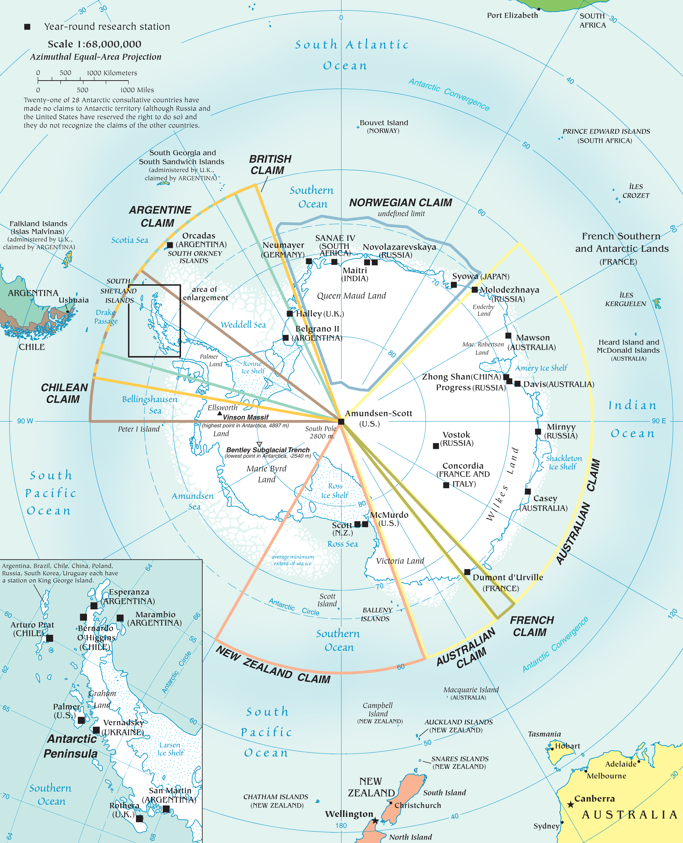
English: Map of the antarctic region
Twenty-one of 28 Antarctic consultative countries have made no claims to Antarctic territory (although Russia and the United States have reserved the right to do so) and they do not recognize the claims of the other countries. Español: Mapa de la Antártida |
| Datum | |
| Bron | PDF at CIA Factbook |
| Auteur | The World Factbook |
Deze afbeelding bevindt zich in het publiek domein omdat het materiaal bevat dat oorspronkelijk afkomstig is van het CIA World Factbook.
|
 |
Bestandsgeschiedenis
Klik op een datum/tijd om het bestand te zien zoals het destijds was.
| Datum/tijd | Miniatuur | Afmetingen | Gebruiker | Opmerking | |
|---|---|---|---|---|---|
| huidige versie | 3 dec 2010 20:10 | | 2.787 × 3.437 (1,4 MB) | Ras67 | better arrangement of Antarctic Peninsula enlargement |
Bestandsgebruik
Dit bestand wordt op de volgende pagina gebruikt: