Bestand:North Holland 1st-10th Century.jpg
Afbeelding in hogere resolutie (1.198 × 585 pixels, bestandsgrootte: 643 kB, MIME-type: image/jpeg)
Beschrijving
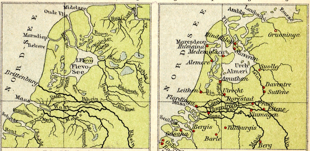
| Beschrijving | Formation of the Zuider Zee during the first millennium A.D. |
| Datum | |
| Bron | Tramplers Geographischer Mittelschulatlas, 8th Ed., Wien (Austria) |
| Auteur |
Licentie
|
Dit werk bevindt zich in het publiek domein in landen en gebieden waar de auteursrechttermijn het leven van de auteur plus 70 jaar of minder is.
| |
| Van dit bestand is vastgesteld dat er geen bekende auteursrechtaanspraken op rusten, alle aanverwante en naburige rechten daarbij inbegrepen. | |
Bestandsgeschiedenis
Klik op een datum/tijd om het bestand te zien zoals het destijds was.
| Datum/tijd | Miniatuur | Afmetingen | Gebruiker | Opmerking | |
|---|---|---|---|---|---|
| huidige versie | 4 jul 2007 14:36 | | 1.198 × 585 (643 kB) | Hermann A.M. Mucke | {{Information |Description=Formation of the Zuider Zee during the first millennium A.D. |Source=Tramplers Geographischer Mittelschulatlas, 8th Ed., Wien (Austria) |Date=1913 |Author= |Permission= |other_versions= }} Category:Old maps of North Holland |
Bestandsgebruik
Dit bestand wordt op de volgende pagina gebruikt: