Lijst van gemeenten in Zuid-Holland: verschil tussen versies
Naar navigatie springen
Naar zoeken springen
(Krimpenerwaard gewoon in de lijst vergeten op te nemen) |
k (→top: replaced: [[File: → [[Bestand: (50)) |
||
| (6 tussenliggende versies door een andere gebruiker niet weergegeven) | |||
| Regel 1: | Regel 1: | ||
| − | {{werk}} |
||
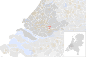
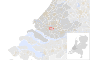
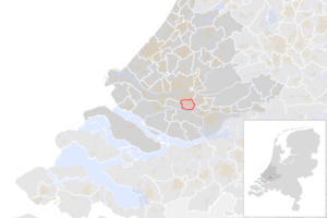
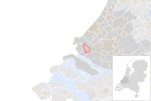
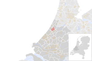
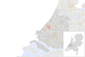
Hieronder zie een lijst met alle 60 gemeenten in de Nederlandse provincie [[Zuid-Holland]]. Hierbij staan de naam, de inwoners en een plaatje met de ligging vermeld. De gegevens zijn voor het laatst in 2016 bijgewerkt. |
Hieronder zie een lijst met alle 60 gemeenten in de Nederlandse provincie [[Zuid-Holland]]. Hierbij staan de naam, de inwoners en een plaatje met de ligging vermeld. De gegevens zijn voor het laatst in 2016 bijgewerkt. |
||
| Regel 13: | Regel 12: | ||
| [[Alblasserdam]] |
| [[Alblasserdam]] |
||
| 19.958 |
| 19.958 |
||
| − | | 8,79 |
+ | | 8,79 km² |
| [[Alblasserdam]] |
| [[Alblasserdam]] |
||
| − | | [[ |
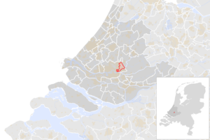
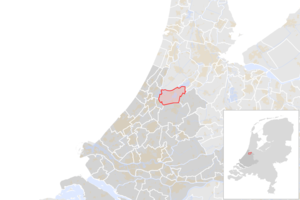
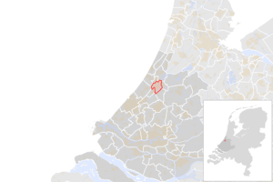
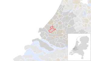
+ | | [[Bestand:NL_-_locator_map_municipality_code_GM0482_(2016).png|300px]] |
|- |
|- |
||
| 2 |
| 2 |
||
| [[Albrandswaard]] |
| [[Albrandswaard]] |
||
| 25.066 |
| 25.066 |
||
| − | | 21,87 |
+ | | 21,87 km² |
| [[Poortugaal]] |
| [[Poortugaal]] |
||
| − | | [[ |
+ | | [[Bestand:NL_-_locator_map_municipality_code_GM0613_(2016).png|300px]] |
|- |
|- |
||
| 3 |
| 3 |
||
| [[Alphen aan den Rijn]] |
| [[Alphen aan den Rijn]] |
||
| 107.930 |
| 107.930 |
||
| − | | 126,58 |
+ | | 126,58 km² |
| [[Alphen aan den Rijn]] |
| [[Alphen aan den Rijn]] |
||
| − | | [[ |
+ | | [[Bestand:NL_-_locator_map_municipality_code_GM0484_(2016).png|300px]] |
|- |
|- |
||
| 4 |
| 4 |
||
| [[Barendrecht]] |
| [[Barendrecht]] |
||
| 47.824 |
| 47.824 |
||
| − | | 19,83 |
+ | | 19,83 km² |
| [[Barendrecht]] |
| [[Barendrecht]] |
||
| − | | [[ |
+ | | [[Bestand:NL_-_locator_map_municipality_code_GM0489_(2016).png|300px]] |
|- |
|- |
||
| 5 |
| 5 |
||
| − | | [[Binnenmaas]] |
||
| − | | 28.852 |
||
| − | | 69,26 km² |
||
| − | | [[Maasdam]] |
||
| − | | [[File:NL_-_locator_map_municipality_code_GM0585_(2016).png|300px]] |
||
| − | |- |
||
| − | | 6 |
||
| [[Bodegraven-Reeuwijk]] |
| [[Bodegraven-Reeuwijk]] |
||
| 33.472 |
| 33.472 |
||
| − | | 75,69 |
+ | | 75,69 km² |
| [[Bodegraven]] |
| [[Bodegraven]] |
||
| − | | [[ |
+ | | [[Bestand:NL_-_locator_map_municipality_code_GM1901_(2016).png|300px]] |
|- |
|- |
||
| − | | |
+ | | 6 |
| [[Brielle]] |
| [[Brielle]] |
||
| 16.653 |
| 16.653 |
||
| − | | 27,56 |
+ | | 27,56 km² |
| [[Brielle]] |
| [[Brielle]] |
||
| − | | [[ |
+ | | [[Bestand:NL_-_locator_map_municipality_code_GM0501_(2016).png|300px]] |
|- |
|- |
||
| − | | |
+ | | 7 |
| [[Capelle aan den IJssel]] |
| [[Capelle aan den IJssel]] |
||
| 66.534 |
| 66.534 |
||
| − | | 14,25 |
+ | | 14,25 km² |
| [[Capelle aan den IJssel]] |
| [[Capelle aan den IJssel]] |
||
| − | | [[ |
+ | | [[Bestand:NL_-_locator_map_municipality_code_GM0502_(2016).png|300px]] |
|- |
|- |
||
| − | | |
+ | | 8 |
| − | | [[Cromstrijen]] |
||
| − | | 12.792 |
||
| − | | 54,37 km² |
||
| − | | [[Numansdorp]] |
||
| − | | [[File:NL_-_locator_map_municipality_code_GM0611_(2016).png|300px]] |
||
| − | |- |
||
| − | | 10 |
||
| [[Delft]] |
| [[Delft]] |
||
| 101.053 |
| 101.053 |
||
| − | | 22,82 |
+ | | 22,82 km² |
| [[Delft]] |
| [[Delft]] |
||
| − | | [[ |
+ | | [[Bestand:NL_-_locator_map_municipality_code_GM0503_(2016).png|300px]] |
|- |
|- |
||
| − | | |
+ | | 9 |
| [[Dordrecht (Nederland)|Dordrecht]] |
| [[Dordrecht (Nederland)|Dordrecht]] |
||
| 118.496 |
| 118.496 |
||
| − | | 79,01 |
+ | | 79,01 km² |
| [[Dordrecht (Nederland)|Dordrecht]] |
| [[Dordrecht (Nederland)|Dordrecht]] |
||
| − | | [[ |
+ | | [[Bestand:NL_-_locator_map_municipality_code_GM0505_(2016).png|300px]] |
|- |
|- |
||
| − | | |
+ | | 10 |
| − | | [[Giessenlanden]] |
||
| − | | 14.600 |
||
| − | | 63,57 km² |
||
| − | | [[Hoornaar]] |
||
| − | | [[File:NL_-_locator_map_municipality_code_GM0689_(2016).png|300px]] |
||
| − | |- |
||
| − | | 13 |
||
| [[Goeree-Overflakkee]] |
| [[Goeree-Overflakkee]] |
||
| 48.405 |
| 48.405 |
||
| − | | 262,00 |
+ | | 262,00 km² |
| [[Middelharnis]] |
| [[Middelharnis]] |
||
| − | | [[ |
+ | | [[Bestand:NL_-_locator_map_municipality_code_GM1924_(2016).png|300px]] |
|- |
|- |
||
| − | | |
+ | | 11 |
| [[Gorinchem]] |
| [[Gorinchem]] |
||
| 35.311 |
| 35.311 |
||
| − | | 18,92 |
+ | | 18,92 km² |
| [[Gorinchem]] |
| [[Gorinchem]] |
||
| − | | [[ |
+ | | [[Bestand:NL_-_locator_map_municipality_code_GM0512_(2016).png|300px]] |
|- |
|- |
||
| − | | |
+ | | 12 |
| [[Gouda]] |
| [[Gouda]] |
||
| 71.449 |
| 71.449 |
||
| − | | 16,86 |
+ | | 16,86 km² |
| [[Gouda]] |
| [[Gouda]] |
||
| − | | [[ |
+ | | [[Bestand:NL_-_locator_map_municipality_code_GM0513_(2016).png|300px]] |
|- |
|- |
||
| − | | |
+ | | 13 |
| [[Den Haag]] ('s-Gravenhage) |
| [[Den Haag]] ('s-Gravenhage) |
||
| 520.704 |
| 520.704 |
||
| − | | 81,88 |
+ | | 81,88 km² |
| [[Den Haag]] |
| [[Den Haag]] |
||
| − | | [[ |
+ | | [[Bestand:NL_-_locator_map_municipality_code_GM0518_(2016).png|300px]] |
|- |
|- |
||
| − | | |
+ | | 14 |
| [[Hardinxveld-Giessendam]] |
| [[Hardinxveld-Giessendam]] |
||
| 17.775 |
| 17.775 |
||
| − | | 16,92 |
+ | | 16,92 km² |
| [[Neder-Hardinxveld]] |
| [[Neder-Hardinxveld]] |
||
| − | | [[ |
+ | | [[Bestand:NL_-_locator_map_municipality_code_GM0523_(2016).png|300px]] |
|- |
|- |
||
| − | | |
+ | | 15 |
| [[Hellevoetsluis]] |
| [[Hellevoetsluis]] |
||
| 38.687 |
| 38.687 |
||
| − | | 31,56 |
+ | | 31,56 km² |
| [[Hellevoetsluis]] |
| [[Hellevoetsluis]] |
||
| − | | [[ |
+ | | [[Bestand:NL_-_locator_map_municipality_code_GM0530_(2016).png|300px]] |
|- |
|- |
||
| − | | |
+ | | 16 |
| [[Hendrik-Ido-Ambacht]] |
| [[Hendrik-Ido-Ambacht]] |
||
| 29.448 |
| 29.448 |
||
| − | | 10,67 |
+ | | 10,67 km² |
| [[Hendrik-Ido-Ambacht]] |
| [[Hendrik-Ido-Ambacht]] |
||
| − | | [[ |
+ | | [[Bestand:NL_-_locator_map_municipality_code_GM0531_(2016).png|300px]] |
|- |
|- |
||
| − | | |
+ | | 17 |
| [[Hillegom]] |
| [[Hillegom]] |
||
| 21.158 |
| 21.158 |
||
| − | | 12,92 |
+ | | 12,92 km² |
| [[Hillegom]] |
| [[Hillegom]] |
||
| − | | [[ |
+ | | [[Bestand:NL_-_locator_map_municipality_code_GM0534_(2016).png|300px]] |
|- |
|- |
||
| − | | |
+ | | 18 |
| + | | [[Hoeksche Waard]] |
||
| + | | |
||
| + | | |
||
| + | | |
||
| + | | |
||
| + | |- |
||
| + | | 19 |
||
| [[Kaag en Braassem]] |
| [[Kaag en Braassem]] |
||
| 26.133 |
| 26.133 |
||
| − | | 63,39 |
+ | | 63,39 km² |
| [[Roelofarendsveen]] |
| [[Roelofarendsveen]] |
||
| − | | [[ |
+ | | [[Bestand:NL_-_locator_map_municipality_code_GM1884_(2016).png|300px]] |
|- |
|- |
||
| − | | |
+ | | 20 |
| [[Katwijk (Zuid-Holland)|Katwijk]] |
| [[Katwijk (Zuid-Holland)|Katwijk]] |
||
| 64.232 |
| 64.232 |
||
| − | | 24,54 |
+ | | 24,54 km² |
| [[Katwijk (Zuid-Holland)|Katwijk]] |
| [[Katwijk (Zuid-Holland)|Katwijk]] |
||
| − | | [[ |
+ | | [[Bestand:NL_-_locator_map_municipality_code_GM0537_(2016).png|300px]] |
|- |
|- |
||
| − | | |
+ | | 21 |
| − | | [[Korendijk]] |
||
| − | | 10.847 |
||
| − | | 77,26 km² |
||
| − | | [[Piershil]] |
||
| − | | [[File:NL_-_locator_map_municipality_code_GM0588_(2016).png|300px]] |
||
| − | |- |
||
| − | | 24 |
||
| [[Krimpen aan den IJssel]] |
| [[Krimpen aan den IJssel]] |
||
| 29.045 |
| 29.045 |
||
| − | | 7,80 |
+ | | 7,80 km² |
| [[Krimpen aan den IJssel]] |
| [[Krimpen aan den IJssel]] |
||
| − | | [[ |
+ | | [[Bestand:NL_-_locator_map_municipality_code_GM0542_(2016).png|300px]] |
|- |
|- |
||
| − | | |
+ | | 22 |
| [[Krimpenerwaard]] |
| [[Krimpenerwaard]] |
||
| 54.800 |
| 54.800 |
||
| − | | 161,3 |
+ | | 161,3 km² |
| [[Stolwijk]] |
| [[Stolwijk]] |
||
| − | | [[ |
+ | | [[Bestand:NL_-_locator_map_municipality_code_GM1931_(2016).png|300px]] |
|- |
|- |
||
| − | | |
+ | | 23 |
| [[Lansingerland]] |
| [[Lansingerland]] |
||
| 59.213 |
| 59.213 |
||
| − | | 54,28 |
+ | | 54,28 km² |
| [[Berkel en Rodenrijs]] |
| [[Berkel en Rodenrijs]] |
||
| − | | [[ |
+ | | [[Bestand:NL_-_locator_map_municipality_code_GM1621_(2016).png|300px]] |
|- |
|- |
||
| − | | |
+ | | 24 |
| − | | [[Leerdam]] |
||
| − | | 20.837 |
||
| − | | 33,79 km² |
||
| − | | [[Leerdam]] |
||
| − | | [[File:NL_-_locator_map_municipality_code_GM0545_(2016).png|300px]] |
||
| − | |- |
||
| − | | 28 |
||
| [[Leiden]] |
| [[Leiden]] |
||
| 122.915 |
| 122.915 |
||
| − | | 21,95 |
+ | | 21,95 km² |
| [[Leiden]] |
| [[Leiden]] |
||
| − | | [[ |
+ | | [[Bestand:NL_-_locator_map_municipality_code_GM0546_(2016).png|300px]] |
|- |
|- |
||
| − | | |
+ | | 25 |
| [[Leiderdorp]] |
| [[Leiderdorp]] |
||
| 26.993 |
| 26.993 |
||
| − | | 11,55 |
+ | | 11,55 km² |
| [[Leiderdorp]] |
| [[Leiderdorp]] |
||
| − | | [[ |
+ | | [[Bestand:NL_-_locator_map_municipality_code_GM0547_(2016).png|300px]] |
|- |
|- |
||
| − | | |
+ | | 26 |
| [[Leidschendam-Voorburg]] |
| [[Leidschendam-Voorburg]] |
||
| 74.222 |
| 74.222 |
||
| − | | 32,70 |
+ | | 32,70 km² |
| [[Leidschendam]] |
| [[Leidschendam]] |
||
| − | | [[ |
+ | | [[Bestand:NL_-_locator_map_municipality_code_GM1916_(2016).png|300px]] |
|- |
|- |
||
| − | | |
+ | | 27 |
| [[Lisse]] |
| [[Lisse]] |
||
| − | | 22. |
+ | | 22.655 |
| + | | 15,69 km² |
||
| − | | [[File:Map_-_NL_-_Municipality_code_0553_(2009).svg|300px]] |
||
| + | | [[Lisse]] |
||
| − | |- |
||
| + | | [[Bestand:NL_-_locator_map_municipality_code_GM0553_(2016).png|300px]] |
||
| − | | 31 |
||
| − | | [[Krimpenerwaard]] |
||
| − | | 53.868 |
||
| − | | [[Bestand:LocatieKrimpenerwaard.png|300px]] |
||
|- |
|- |
||
| − | | |
+ | | 28 |
| + | | [[Maassluis]] |
||
| + | | 32.341 |
||
| + | | 8,49 km² |
||
| [[Maassluis]] |
| [[Maassluis]] |
||
| + | | [[Bestand:NL_-_locator_map_municipality_code_GM0556_(2016).png|300px]] |
||
| − | | 32.230 |
||
| − | | [[File:Map_-_NL_-_Municipality_code_0556_(2009).svg|300px]] |
||
|- |
|- |
||
| − | | |
+ | | 29 |
| [[Midden-Delfland]] |
| [[Midden-Delfland]] |
||
| − | | 18. |
+ | | 18.880 |
| + | | 47,35 km² |
||
| − | | [[File:Map_-_NL_-_Municipality_code_1842_(2009).svg|300px]] |
||
| + | | [[Schipluiden]] |
||
| + | | [[Bestand:NL_-_locator_map_municipality_code_GM1842_(2016).png|300px]] |
||
|- |
|- |
||
| − | | |
+ | | 30 |
| − | | [[ |
+ | | [[Molenlanden]] |
| − | | |
+ | | |
| + | | |
||
| − | | [[File:Map_-_NL_-_Municipality_code_1927_(2012).svg|300px]] |
||
| + | | |
||
| + | | |
||
|- |
|- |
||
| − | | |
+ | | 31 |
| [[Nieuwkoop]] |
| [[Nieuwkoop]] |
||
| − | | 27. |
+ | | 27.523 |
| + | | 78,88 km² |
||
| − | | [[File:Map_-_NL_-_Municipality_code_0569_(2009).svg|300px]] |
||
| + | | [[Nieuwveen]] |
||
| + | | [[Bestand:NL_-_locator_map_municipality_code_GM0569_(2016).png|300px]] |
||
|- |
|- |
||
| − | | |
+ | | 32 |
| [[Nissewaard]] |
| [[Nissewaard]] |
||
| − | | |
+ | | 85.430 |
| + | | 82,25 km² |
||
| − | | [[Bestand:LocatieNissewaard.png|300px]] |
||
| + | | [[Spijkenisse]] |
||
| + | | [[Bestand:NL_-_locator_map_municipality_code_GM1930_(2016).png|300px]] |
||
|- |
|- |
||
| − | | |
+ | | 33 |
| [[Noordwijk (Zuid-Holland)|Noordwijk]] |
| [[Noordwijk (Zuid-Holland)|Noordwijk]] |
||
| − | | 25. |
+ | | 25.765 |
| + | | 35,48 km² |
||
| − | | [[File:Map_-_NL_-_Municipality_code_0575_(2009).svg|300px]] |
||
| + | | [[Noordwijk (Zuid-Holland)|Noordwijk]] |
||
| + | | [[Bestand:NL_-_locator_map_municipality_code_GM0575_(2016).png|300px]] |
||
|- |
|- |
||
| − | | |
+ | | 34 |
| − | | [[Noordwijkerhout]] |
||
| − | | 15.976 |
||
| − | | [[File:Map_-_NL_-_Municipality_code_0576_(2009).svg|300px]] |
||
| − | |- |
||
| − | | 39 |
||
| [[Oegstgeest]] |
| [[Oegstgeest]] |
||
| − | | |
+ | | 23.312 |
| + | | 7,30 km² |
||
| − | | [[File:Map_-_NL_-_Municipality_code_0579_(2009).svg|300px]] |
||
| + | | [[Oegstgeest]] |
||
| − | |- |
||
| + | | [[Bestand:NL_-_locator_map_municipality_code_GM0579_(2016).png|300px]] |
||
| − | | 40 |
||
| − | | [[Oud-Beijerland]] |
||
| − | | 23.683 |
||
| − | | [[File:Map_-_NL_-_Municipality_code_0584_(2009).svg|300px]] |
||
|- |
|- |
||
| − | | |
+ | | 35 |
| + | | [[Papendrecht]] |
||
| + | | 32.276 |
||
| + | | 9,48 km² |
||
| [[Papendrecht]] |
| [[Papendrecht]] |
||
| + | | [[Bestand:NL_-_locator_map_municipality_code_GM0590_(2016).png|300px]] |
||
| − | | 32.177 |
||
| − | | [[File:Map_-_NL_-_Municipality_code_0590_(2009).svg|300px]] |
||
|- |
|- |
||
| − | | |
+ | | 36 |
| [[Pijnacker-Nootdorp]] |
| [[Pijnacker-Nootdorp]] |
||
| − | | |
+ | | 52.026 |
| + | | 37,36 km² |
||
| − | | [[File:Map_-_NL_-_Municipality_code_1926_(2009).svg|300px]] |
||
| + | | [[Pijnacker]] |
||
| + | | [[Bestand:NL_-_locator_map_municipality_code_GM1926_(2016).png|300px]] |
||
|- |
|- |
||
| − | | |
+ | | 37 |
| + | | [[Ridderkerk]] |
||
| + | | 45.135 |
||
| + | | 23,74 km² |
||
| [[Ridderkerk]] |
| [[Ridderkerk]] |
||
| + | | [[Bestand:NL_-_locator_map_municipality_code_GM0597_(2016).png|300px]] |
||
| − | | 45.204 |
||
| − | | [[File:Map_-_NL_-_Municipality_code_0597_(2009).svg|300px]] |
||
|- |
|- |
||
| − | | |
+ | | 38 |
| + | | [[Rijswijk (Zuid-Holland)|Rijswijk]] |
||
| + | | 49.671 |
||
| + | | 14,05 km² |
||
| [[Rijswijk (Zuid-Holland)|Rijswijk]] |
| [[Rijswijk (Zuid-Holland)|Rijswijk]] |
||
| + | | [[Bestand:NL_-_locator_map_municipality_code_GM0603_(2016).png|300px]] |
||
| − | | 47.674 |
||
| − | | [[File:Map_-_NL_-_Municipality_code_0603_(2009).svg|300px]] |
||
|- |
|- |
||
| − | | |
+ | | 39 |
| + | | [[Rotterdam]] |
||
| + | | 631.155 |
||
| + | | 208,80 km² |
||
| [[Rotterdam]] |
| [[Rotterdam]] |
||
| + | | [[Bestand:NL_-_locator_map_municipality_code_GM0599_(2016).png|300px]] |
||
| − | | 619.879 |
||
| − | | [[File:Map_-_NL_-_Municipality_code_0599_(2009).svg|300px]] |
||
|- |
|- |
||
| − | | |
+ | | 40 |
| + | | [[Schiedam]] |
||
| + | | 77.155 |
||
| + | | 18,02 km² |
||
| [[Schiedam]] |
| [[Schiedam]] |
||
| + | | [[Bestand:NL_-_locator_map_municipality_code_GM0606_(2016).png|300px]] |
||
| − | | 76.650 |
||
| − | | [[File:Map_-_NL_-_Municipality_code_0606_(2009).svg|300px]] |
||
|- |
|- |
||
| − | | |
+ | | 41 |
| + | | [[Sliedrecht]] |
||
| + | | 24.978 |
||
| + | | 12,83 km² |
||
| [[Sliedrecht]] |
| [[Sliedrecht]] |
||
| + | | [[Bestand:NL_-_locator_map_municipality_code_GM0610_(2016).png|300px]] |
||
| − | | 24.592 |
||
| − | | [[File:Map_-_NL_-_Municipality_code_0610_(2009).svg|300px]] |
||
|- |
|- |
||
| − | | |
+ | | 42 |
| − | | [[Strijen]] |
||
| − | | 8.680 |
||
| − | | [[File:Map_-_NL_-_Municipality_code_0617_(2009).svg|300px]] |
||
| − | |- |
||
| − | | 49 |
||
| [[Teylingen (gemeente)|Teylingen]] |
| [[Teylingen (gemeente)|Teylingen]] |
||
| − | | |
+ | | 36.022 |
| + | | 28,55 km² |
||
| − | | [[File:Map_-_NL_-_Municipality_code_1525_(2009).svg|300px]] |
||
| + | | [[Voorhout]] en [[Sassenheim]] |
||
| + | | [[Bestand:NL_-_locator_map_municipality_code_GM1525_(2016).png|300px]] |
||
|- |
|- |
||
| − | | |
+ | | 43 |
| [[Vlaardingen]] |
| [[Vlaardingen]] |
||
| − | | 71. |
+ | | 71.852 |
| + | | 23,64 km² |
||
| − | | [[File:Map_-_NL_-_Municipality_code_0622_(2009).svg|300px]] |
||
| + | | [[Vlaardingen]] |
||
| + | | [[Bestand:NL_-_locator_map_municipality_code_GM0622_(2016).png|300px]] |
||
|- |
|- |
||
| − | | |
+ | | 44 |
| [[Voorschoten]] |
| [[Voorschoten]] |
||
| − | | |
+ | | 25.249 |
| + | | 11,16 km² |
||
| − | | [[File:Map_-_NL_-_Municipality_code_0626_(2009).svg|300px]] |
||
| + | | [[Voorschoten]] |
||
| + | | [[Bestand:NL_-_locator_map_municipality_code_GM0626_(2016).png|300px]] |
||
|- |
|- |
||
| − | | |
+ | | 45 |
| + | | [[Waddinxveen]] |
||
| + | | 26.166 |
||
| + | | 27,90 km² |
||
| [[Waddinxveen]] |
| [[Waddinxveen]] |
||
| + | | [[Bestand:NL_-_locator_map_municipality_code_GM0627_(2016).png|300px]] |
||
| − | | 25.555 |
||
| − | | [[File:Map_-_NL_-_Municipality_code_0627_(2009).svg|300px]] |
||
|- |
|- |
||
| − | | |
+ | | 46 |
| − | | [[ |
+ | | [[Wassenaar]] |
| − | | 25. |
+ | | 25.931 |
| + | | 50,92 km² |
||
| − | | [[File:Map_-_NL_-_Municipality_code_0629_(2009).svg|300px]] |
||
| + | | [[Wassenaar]] |
||
| + | | [[Bestand:NL_-_locator_map_municipality_code_GM0629_(2016).png|300px]] |
||
|- |
|- |
||
| − | | |
+ | | 47 |
| [[Westland (gemeente)|Westland]] |
| [[Westland (gemeente)|Westland]] |
||
| − | | |
+ | | 104.844 |
| + | | 79,53 km² |
||
| − | | [[File:Map_-_NL_-_Municipality_code_1783_(2009).svg|300px]] |
||
| + | | [[Naaldwijk]] |
||
| + | | [[Bestand:NL_-_locator_map_municipality_code_GM1783_(2016).png|300px]] |
||
|- |
|- |
||
| − | | |
+ | | 48 |
| [[Westvoorne]] |
| [[Westvoorne]] |
||
| − | | 14. |
+ | | 14.188 |
| + | | 53,23 km² |
||
| − | | [[File:Map_-_NL_-_Municipality_code_0614_(2009).svg|300px]] |
||
| + | | [[Rockanje]] |
||
| − | |- |
||
| + | | [[Bestand:NL_-_locator_map_municipality_code_GM0614_(2016).png|300px]] |
||
| − | | 56 |
||
| − | | [[Zederik]] |
||
| − | | 13.681 |
||
| − | | [[File:Map_-_NL_-_Municipality_code_0707_(2009).svg|300px]] |
||
|- |
|- |
||
| − | | |
+ | | 49 |
| [[Zoetermeer]] |
| [[Zoetermeer]] |
||
| − | | |
+ | | 124.399 |
| + | | 34,55 km² |
||
| − | | [[File:Map_-_NL_-_Municipality_code_0637_(2009).svg|300px]] |
||
| + | | [[Zoetermeer]] |
||
| + | | [[Bestand:NL_-_locator_map_municipality_code_GM0637_(2016).png|300px]] |
||
|- |
|- |
||
| − | | |
+ | | 50 |
| [[Zoeterwoude]] |
| [[Zoeterwoude]] |
||
| − | | 8. |
+ | | 8.178 |
| + | | 21,26 km² |
||
| − | | [[File:Map_-_NL_-_Municipality_code_0638_(2009).svg|300px]] |
||
| + | | [[Zoeterwoude-Dorp]] |
||
| + | | [[Bestand:NL_-_locator_map_municipality_code_GM0638_(2016).png|300px]] |
||
|- |
|- |
||
| − | | |
+ | | 51 |
| [[Zuidplas (gemeente)|Zuidplas]] |
| [[Zuidplas (gemeente)|Zuidplas]] |
||
| − | | |
+ | | 41.088 |
| + | | 59,37 |
||
| − | | [[File:Map_-_NL_-_Gemeente_Zuidplas.svg|300px]] |
||
| + | | [[Nieuwerkerk aan den IJssel]] |
||
| + | | [[Bestand:NL_-_locator_map_municipality_code_GM1892_(2016).png|300px]] |
||
|- |
|- |
||
| − | | |
+ | | 52 |
| + | | [[Zwijndrecht (Nederland)|Zwijndrecht]] |
||
| + | | 44.424 |
||
| + | | 20,35 km² |
||
| [[Zwijndrecht (Nederland)|Zwijndrecht]] |
| [[Zwijndrecht (Nederland)|Zwijndrecht]] |
||
| + | | [[Bestand:NL_-_locator_map_municipality_code_GM0642_(2016).png|300px]] |
||
| − | | 44.546 |
||
| − | | [[File:Map_-_NL_-_Municipality_code_0642_(2009).svg|300px]] |
||
|- |
|- |
||
|} |
|} |
||
{{Navigatie gemeentelijsten Nederland}} |
{{Navigatie gemeentelijsten Nederland}} |
||
| − | [[Categorie: |
+ | [[Categorie:Gemeente in Zuid-Holland| ]] |
[[Categorie:Lijst van gemeenten in Nederland|Z]] |
[[Categorie:Lijst van gemeenten in Nederland|Z]] |
||
Huidige versie van 12 feb 2021 om 18:52
Hieronder zie een lijst met alle 60 gemeenten in de Nederlandse provincie Zuid-Holland. Hierbij staan de naam, de inwoners en een plaatje met de ligging vermeld. De gegevens zijn voor het laatst in 2016 bijgewerkt.
| Gemeenten in Nederland | |||
|---|---|---|---|
| Drenthe - Flevoland - Friesland - Gelderland - Groningen - Limburg - Noord-Brabant - Noord-Holland - Overijssel - Utrecht - Zeeland - Zuid-Holland | |||
